


 Technology")
WHEN PRECISION MATTERS MOST
EDP’s surveying team delivers with unmatched accuracy and reliability.
Backed by over three decades of expertise, we combine advanced technology, rigorous research, and deep field experience to produce highly precise, field-to-finish survey data. Our reputation is built on delivering dependable results that clients can trust, project after project.
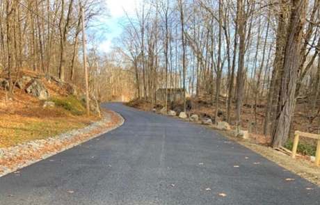
Our surveying process is built for clarity and efficiency. We begin by thoroughly researching historical records and property documents to establish a definitive understanding of your site. This foundational work informs our field crews, who use the latest robotic total stations, high-accuracy GPS, and UAV (drone) technology to capture the terrain. This meticulous approach ensures the data we deliver is not only precise but also contextually sound, providing a reliable foundation for design, construction, and legal purposes
Our services include:
- Boundary Surveys
- Topographic Surveys
- Right-of-way and Easement Surveys
- Construction Stakeout and Grading
- Route and Utility Surveys
- Aerial Photo Control Surveys
- Legal Descriptions
- ALTA/NSPS Land Title Surveys
- Certified Mortgage Surveys
- NYS Appropriation Surveys
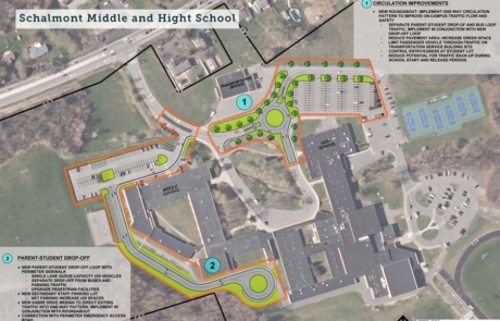
SURVEY SOLUTIONS
Leveraging decades of experience and cutting-edge technology for definitive survey data.
More Than Just Data Points
The information we gather becomes a powerful tool for our clients.
This allows you to make informed decision-making from the earliest planning stages through final construction. Our detailed surveys help identify potential challenges, clarify property rights, and ensure your project moves forward with confidence, avoiding costly delays and disputes.

